
Wednesday, October 26, 2011

Seattle
Jeanne and I arrived home last night after a 10-day vacation visiting sights, family and friends throughout the Southeast. During my five-week absence, I transition from 45 years of post-college employment to retirement. Part of our Southeast tour included a visit to Pensacola, Florida, where I started my first job after college as a Naval Aviator (above).
Summing up the Eastern Seaboard trip, it was just as much fun an last year's cross country trip, only shorter. Last year we took seven weeks to cover 3,400 miles, spending time in 15 states. This time it was 13 states over 24 days. Comparing the two trips, on this one we experienced more variety in scenery and weather. I think it only rained a couple of days for short periods on the cross country and this time it rained all day several times and part of the time on many other days. But, as promised, the food on this trip was much better, especially on days when we could choose our own restaurants, because of our proximity to great seafood. Further, the hotels were better this time, probably because there were more options. As with the last trip, the quality of the people was the best part of the experience. I thoroughly enjoyed more time with my nine friends from last year's ride and the opportunity to make new acquaintances.
One other observation has to do with my bike. Despite the difficult weather we encountered I had no trouble with my bike. I attribute this to the knowledge I gained on my last trip about how to properly clean my bike and to the two maintenance courses I took over the winter which taught me how to make the minor adjustments I occasionally needed. A little luck may have been involved as well.
Today is the first day since I entered kindergarden at the age of four when I have no future obligations. Though it feels pretty good now, I'm sure I will need to come up with some ideas about how to spend my time. I know those ideas will include future cycling adventures which will be highlighted on this same blog. Thanks for your interest and I hope to peak your curiosity here again soon. Bill Whitlow, October 26, 2011
Saturday, October 15, 2011

St. Augustine, FL to Daytona Beach, FL - 54 miles
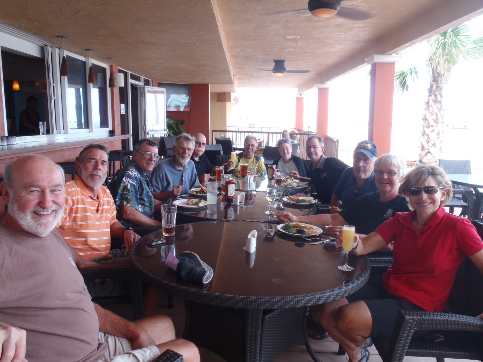
Another beautiful ride along the coast for our last day of the trip. Over the past several days we have been passed by several motorcycles. Most were on their way to Daytona Beach for Biktoberfest 2011. One of the bikers (as opposed to cyclists) I talked with on one of my three ferry rides yesterday guessed that there would be 100,000 bikers in Daytona Beach. As we entered the city, I think he was correct. In the downtown area, we had trouble getting through for all the traffic, mostly bikers (above). But we made it through and are staying at a beautiful hotel with a balcony view of the Atlantic Ocean. Tonight we have our farewell dinner and tomorrow Jeanne and I leave for a 10-day vacation around the Southeast, starting in Pensacola, Florida tomorrow evening.
Statistics. For all those quantitative folks in the audience, here are the final numbers for the trip as recorded by my Garmin GPS bicycle computer - 1,624 total miles which took 104 hours and 24 minutes over 21 days of riding. The total elevation gained was 25,420 (adding up all our climbs), average speed 15.6 mph, 91,859 calories burned and three flats for me.
Statistics. For all those quantitative folks in the audience, here are the final numbers for the trip as recorded by my Garmin GPS bicycle computer - 1,624 total miles which took 104 hours and 24 minutes over 21 days of riding. The total elevation gained was 25,420 (adding up all our climbs), average speed 15.6 mph, 91,859 calories burned and three flats for me.
Dinner in St. Augustine
Jeanne arrived at the hotel right on time last night at 7:00 Eastern Time. We then drove her rental car to old town St. Augustine. This is a charming area with many restaurants, bars and shops in a small area of the old city reminiscent of the French Quarter of New Orleans. There are many narrow streets, which seem more like alleys, with lots of action on a Friday night. We had a great meal and both went to sleep early. I had another 54 miles to do this morning and Jeanne had been up since 4:00AM Pacific, having flown all day from Seattle to Jacksonville and driving another hour to St. Augustine.

Friday, October 14, 2011


Fernandia Beach, FL to St. Augustine, FL - 59 miles+++
Today we had the best weather, traffic, roads and scenery of the entire trip. For the first 20 miles we rode in a bike lane along a quiet road next to the ocean on Amelia Island. We were then scheduled to take a ferry to Jacksonville. Fortunately for me, the ferry leaves every half hour and takes 10 minutes to make the crossing. We arrived just as the ferry was pulling out (I am on the right above), so we sat at a picnic table and waited (above). As the ferry was about to land at Jacksonville, I realized I left my camera back at the picnic table. So I went back to get it while four of my buddies waited for me. Fortunately, I didn't have to make the crossing alone. A beautiful butterfly landed on my front wheel axle and stayed there while I crossed over and back (above). After we left the ferry we had some busy roads through Jacksonville Beach for about 10 miles until we again hit a quiet road along the beach into St. Augustine, site of the fountain of youth. We rode to the alleged site of the fountain of youth, but it is a pretty hooky tourist trap, so we didn't go in. Jeanne arrives in a couple of hours so I may bag the scheduled dinner at Denny's tonight and find a nicer place to treat my bride after her long day on airplanes.
Thursday, October 13, 2011


Brunswick, GA to Fernandia Beach, FL - 62 miles
Now that we're in Florida, it looks like the sun is here to stay. Had a nice, easy ride today, but we remained inland and the roads were pretty busy. Over the past few days several logging trucks have been on the roads. The difference between the logging trucks here and those along US 101 on the Olympic Peninsula is that the logs here are smaller in diameter. Given all the paper mills around, I assume they are being used for paper manufacture, not for lumber. However, knowing the many safety issues these trucks have had in the Pacific Northwest, I'm nervous every time one passes. I always check to be sure there are steel poles on the sides of the truck and straps around all the logs; which there have been. About three miles before the hotel we crossed another Atlantic Intracoastal Waterway bridge (above) which took us onto Amelia Island. Just past the hotel is a beautiful beach with white sand, just like those I remember in Pensacola (group picture above). We have two days left on the trip, both of which should be along the Florida coast. Tomorrow's destination is St. Augustine, where Jeanne will join me after dinner.
Wednesday, October 12, 2011


Savannah, GA to Brunswick, GA - 83 miles
We got a slow start today. After a mere 2.3 miles of riding through Savannah rush-hour traffic, we came upon a freight train stopped on the tracks in the middle of the road (above). It kept going back and forth, probably either switching tracks or adding cars. We were there about 20 minutes, and a long line of cars gathered as we waited. When the train finally moved out of our way we held up traffic even further on the single-lane road. We were not very popular. Today was actually a pretty boring day as there was little scenery; we were inland all day. The weather was very muggy and cloudy through most of the ride but we had some sun breaks just before we entered Brunswick. This was our last relatively long day as we coast into Daytona Beach with rides of 61, 57 and 50 miles the remaining three days of the trip. Tomorrow we enter Florida, ending the day at Amelia Island.
A note on the Atlantic Intracoastal Waterway. Since we left Norfolk, we have spent much of our time on this system. To quote from Wikipedia "The Intracoastal Waterway is a 3,000-mile waterway along the Atlantic and Gulf coasts of the United States. Some lengths consist of natural inlets, salt-water rivers, bays, and sounds; others are artificial canals. It provides a navigable route along its length without many of the hazards of travel on the open sea....The waterway runs for most of the length of the Eastern Seaboard, from its unofficial northern terminus at the Manasquan River in New Jersey, where it connects with the Atlantic Ocean at the Manasquan Inlet, then around the Gulf of Mexico to Brownsville, Texas.... The ICW is a significant portion of the Great Loop, a circumnavigation route encircling the eastern half of the continental United States....The waterway consists of three non-contiguous segments: the Gulf Intracoastal Waterway, extending from Brownsville, Texas east to Carrabelle, Florida; a second section of the Gulf Intracoastal Waterway, beginning at Tarpon Springs, Florida, and extending south to Fort Myers, Florida; and the Atlantic Intracoastal Waterway, extending from Key West, Florida to Norfolk, Virginia." The ride over the many bridges and along the marshes has been very interesting. We have seen a lots of fisherman as well as numerous forms of wildlife, in addition to the mosquitoes, over the many days we have spent on this system (above). Climbing to the apex of the bridges has accounted for most of the elevation gain we have had since we left New Jersey.
A note on the Atlantic Intracoastal Waterway. Since we left Norfolk, we have spent much of our time on this system. To quote from Wikipedia "The Intracoastal Waterway is a 3,000-mile waterway along the Atlantic and Gulf coasts of the United States. Some lengths consist of natural inlets, salt-water rivers, bays, and sounds; others are artificial canals. It provides a navigable route along its length without many of the hazards of travel on the open sea....The waterway runs for most of the length of the Eastern Seaboard, from its unofficial northern terminus at the Manasquan River in New Jersey, where it connects with the Atlantic Ocean at the Manasquan Inlet, then around the Gulf of Mexico to Brownsville, Texas.... The ICW is a significant portion of the Great Loop, a circumnavigation route encircling the eastern half of the continental United States....The waterway consists of three non-contiguous segments: the Gulf Intracoastal Waterway, extending from Brownsville, Texas east to Carrabelle, Florida; a second section of the Gulf Intracoastal Waterway, beginning at Tarpon Springs, Florida, and extending south to Fort Myers, Florida; and the Atlantic Intracoastal Waterway, extending from Key West, Florida to Norfolk, Virginia." The ride over the many bridges and along the marshes has been very interesting. We have seen a lots of fisherman as well as numerous forms of wildlife, in addition to the mosquitoes, over the many days we have spent on this system (above). Climbing to the apex of the bridges has accounted for most of the elevation gain we have had since we left New Jersey.
Tuesday, October 11, 2011


It's a rainy night in Georgia
Though it rained most of last night, today was like Seattle, cloudy, but no rain. I got a haircut this morning so I will look good for Jeanne's arrival in St. Augustine, Florida on Friday (see above). Three of us then wondered around Savannah and took a riverboat cruise on the Savannah River. I was surprised to learn that this is the second largest container port in the US (LA is the largest) and is geographically the most western port on the East Coast. It's longitude is west of Pittsburgh, PA. The river tour gave a different perspective from the trolly tour Jeanne and I took last time I was here. Back on the bike again tomorrow as we head for Brunswick, Georgia.
Monday, October 10, 2011


Beaufort, NC to Savannah, GA - 47 miles
Fortunately, today was a short day, because it rained the entire ride. Leaving Beaufort, we crossed several bridges with heavy traffic. After about 10 miles, we got to less traveled roads, but the rain continued. About 43 miles into the ride, we entered Georgia on a road that was too busy for pictures, and rode across the beautiful Talmadge Bridge, spanning the Back River, Hutchinson Island and the Savanah River, into downtown Savannah. Savannah is a beautiful city which Jeanne and I were fortunate enough to have visited a few years back after we left Charleston. I am looking forward to spending an extra day here, our last rest day of the trip.
I'd like to comment on the subject of mosquitoes. I make a point not to say anything negative about places in my blog. However, I must say that the mosquitoes have been pretty bad since we reached the south part of North Carolina. At one point on the day we were sprinting to make the noon ferry to Ocracoke Island, several riders stopped to relieve themselves on the side of the rode. I stopped as well, but was so quickly swarmed with mosquitoes that I pressed on despite the full bladder. Yesterday, the same thing happened when I stopped to take a picture of the ruins of an old church outside Beaufort. I was so busy swatting the pests that the picture I took of the church was blurred, so it didn't make last night's blog. However, a fellow rider e-mailed a better picture this afternoon. What was so interesting was that it appeared to be a very large church in the middle of nowhere. Note the Spanish Moss on the trees in the picture. The plaque above gives its history, which is very interesting. It was burned by the British in The Revolutionary War and again by the "Federal Army" in 1865. Apparently, they gave up and had have not rebuilt it. A fellow rider who is also a former high school history teacher mentioned that in the South they don't recognize the "civil war," so the plaque doesn't use the term "Union Army."
I'd like to comment on the subject of mosquitoes. I make a point not to say anything negative about places in my blog. However, I must say that the mosquitoes have been pretty bad since we reached the south part of North Carolina. At one point on the day we were sprinting to make the noon ferry to Ocracoke Island, several riders stopped to relieve themselves on the side of the rode. I stopped as well, but was so quickly swarmed with mosquitoes that I pressed on despite the full bladder. Yesterday, the same thing happened when I stopped to take a picture of the ruins of an old church outside Beaufort. I was so busy swatting the pests that the picture I took of the church was blurred, so it didn't make last night's blog. However, a fellow rider e-mailed a better picture this afternoon. What was so interesting was that it appeared to be a very large church in the middle of nowhere. Note the Spanish Moss on the trees in the picture. The plaque above gives its history, which is very interesting. It was burned by the British in The Revolutionary War and again by the "Federal Army" in 1865. Apparently, they gave up and had have not rebuilt it. A fellow rider who is also a former high school history teacher mentioned that in the South they don't recognize the "civil war," so the plaque doesn't use the term "Union Army."
Sunday, October 9, 2011


Charleston, SC to Beaufort, SC
Another great riding day, with good weather and light Sunday traffic. However, based on the forecast, today was probably our last dry day for awhile. After 18 miles, we left the multi-lane highways outside Charleston and began a nice stretch along country roads. Someone in our group pointed out several days ago that the number of churches seems to increase the further south we go. Today being Sunday, that trend was especially noticeable. If fact, our only rest stop was in the parking lot of Saint Paul's Community Methodist Church. While we were snacking, a couple of church ladies came out to greet us and encourage us to come in and worship with them. My friend Doug from England told them that we could only afford the time if they had Gatorade on tap and Cliff Bars. They had no such facilities so we settled for a picture with them instead (above). As we approached Beaufort, we went by the Marine Corps Air Station. On display at the entrance were three airplanes, one of which, the F-8 Corsair, was one of my favorite planes, though I never flew it (on the right above). Used in Vietnam by the Navy and Marines, it is a classic supersonic fighter with only the pilot and limited electronics. I remember a poster in the office of our commanding officer when I was in primary jet training showing the silhouette of the airplane at night, afterburner on, with the caption "The Last of the Gunfighters." The other two airplanes are an F-4 Phantom on the left and a F-18 Hornet in the middle. Tomorrow, we have a relatively easy day, peddling 46 miles to our last rest day in Savannah, Georgia. It's hardly worth putting on the butt butter for only 46 miles.
Saturday, October 8, 2011


Little River, SC to Charleston, SC - 120 miles
First off, let me say that Charleston is my favorite city in the South. Jeanne and I were fortunate enough to attend a wedding here a few years ago and I just love the historic downtown area. Tonight, we had a great dinner in the historic district topped off by listening to a jazz trio featuring Robert Lewis, son of Jan Lewis. Jan rode with us last year on the cross-country and had the distinction of turning 66 on Route 66. Robert sent her a cake for the occasion which we all enjoyed. She is with us again on this trip. Robert plays the tenor sax and teaches at Charleston College (Jan and Robert are pictured above).
We had another great day for riding today. Good weather and the wind at our backs as we covered 120 miles, the longest ride of this trip. About 16 miles into the trip, we rode through Myrtle Beach. Unlike most of the coastal towns we have passed through since leaving Maine, we could actually see the ocean for a time. On most of the roads along the coast since New Jersey, either houses, hotels, condos or sand dunes came between us and a view of the ocean. 113 miles into the trip we crossed the Arthur Ravenel Jr. Bridge, leading into Charleston. This beautiful bridge is also known as the New Cooper River Bridge and connects Mt. Pleasant with Charleston. It has a nice, 2.9-mile pedestrian/bike path which we used for the crossing. Tomorrow, we head for Beaufort, South Carolina, home of the Parris Island Marine Corps Recruit Depot.
We had another great day for riding today. Good weather and the wind at our backs as we covered 120 miles, the longest ride of this trip. About 16 miles into the trip, we rode through Myrtle Beach. Unlike most of the coastal towns we have passed through since leaving Maine, we could actually see the ocean for a time. On most of the roads along the coast since New Jersey, either houses, hotels, condos or sand dunes came between us and a view of the ocean. 113 miles into the trip we crossed the Arthur Ravenel Jr. Bridge, leading into Charleston. This beautiful bridge is also known as the New Cooper River Bridge and connects Mt. Pleasant with Charleston. It has a nice, 2.9-mile pedestrian/bike path which we used for the crossing. Tomorrow, we head for Beaufort, South Carolina, home of the Parris Island Marine Corps Recruit Depot.
Friday, October 7, 2011

Jacksonville, NC to Little River, SC - 111 miles
The best thing about today is that when I woke up, I found out the Yankees are out of the playoffs. We had good weather, including another tail wind today. However, the ride wasn't as scenic. For the most part, we were riding away from the ocean on busy roads. This was the longest ride of the trip so far and tomorrow's will be even longer. However, we did see our first example of spanish moss hanging from the trees, which are now mostly evergreens. We are staying on a scenic little harbor in Little River, South Carolina, having crossed the border about three miles before we reached the hotel. Tomorrow, we will cover about 119 miles followed by a jazz concert in downtown Charleston. The son of one of our riders from this and the cross-country trip plays the saxophone. So tomorrow's blog posting will probably be late.
Thursday, October 6, 2011


Rest day and Ocracoke Island, NC to Jacksonville, NC - 87 miles+
I just finished two great days. The weather has been good, with sunny skies and highs in the mid-to-high 70's. I didn't post a blog on my rest day yesterday because I didn't do much. Just cleaned my bike and read by the pool next to the harbor. Some of the folks chose to ride 14 miles to the other end of the island, catch a ferry to Cape Hatteras, and ride another 17 miles to the lighthouse there. My butt wasn't up for that. Including the miles today, we will ride 308 miles in three days before tapering down to 78 and 47 going into our next rest day in Savannah, Georgia.
We began today in an unusual way; by eating breakfast on the ferry. We headed to the dock right out of the hotel at 6:45 for the ferry to Cedar Island, NC. Our support staff prepared an excellent breakfast which we ate on the second deck of the ship, which we pretty much took over. After landing at 10:00, we began the 87-mile ride to Jacksonville. It was a beautiful ride along the coast with a 10 mph wind at our backs. I averaged 16.4 mph without the benefit of a pace line. One heartbreaking observation was the many modestly-sized houses along the way with piles of debris in the front yards of what had been their first-floor furnishings (see above). They were all victims of Hurricane Irene. A more cheerful note was the many signs we saw as we rode by USMC's Camp Lejeune, here in Jacksonville, welcoming the troops home by name. The fence that lines the perimeter of the base was covered with the sentimental messages from family and friends. Tomorrow, we head for Myrtle Beach, South Carolina.
We began today in an unusual way; by eating breakfast on the ferry. We headed to the dock right out of the hotel at 6:45 for the ferry to Cedar Island, NC. Our support staff prepared an excellent breakfast which we ate on the second deck of the ship, which we pretty much took over. After landing at 10:00, we began the 87-mile ride to Jacksonville. It was a beautiful ride along the coast with a 10 mph wind at our backs. I averaged 16.4 mph without the benefit of a pace line. One heartbreaking observation was the many modestly-sized houses along the way with piles of debris in the front yards of what had been their first-floor furnishings (see above). They were all victims of Hurricane Irene. A more cheerful note was the many signs we saw as we rode by USMC's Camp Lejeune, here in Jacksonville, welcoming the troops home by name. The fence that lines the perimeter of the base was covered with the sentimental messages from family and friends. Tomorrow, we head for Myrtle Beach, South Carolina.
Tuesday, October 4, 2011

Kill Devil Hills, NC to Ocracoke Island, NC - 80 miles+
Riding with the Big Dogs. The Big Dogs are a half dozen riders who go out fast, ride in a pace line, and are the first ones to the hotel, usually arriving between 1:00 and 2:00. In addition to being strong cyclists, they ride in a pace line most of the time. A pace line is when cyclists ride in single file so the lead rider breaks the wind and the others get the benefit of riding in the leader's slip stream. They alternate leaders about every mile. I generally don't like to ride in a pace line because, unless you are the leader, you spend most of your time staring at the back tire of the bike in front of you so you don't have an accident if that rider slows quickly. They tend to travel between 15 and 25 mph with one to two feet between the riders' tires. The group I ride with, which we have come to call the Pedigrees, take our time, taking pictures, stopping for bathroom breaks and enjoying leisurely lunches. But today, we were forced to ride with the Big Dogs. That was because, as a result of our amended route due to Hurricane Irene, we needed to ride 80 miles in just over five hours to arrive at our ferry by noon. Because of the distance and time constraints our 25 riders were divided into two groups. Half the riders were instructed to ride in the vans to the snack stop, about 35 miles out, then ride to the ferry. The rest of us were free to try to cover the 80 miles in five hours, if we could. If not, we too would have to jump in the vans. The only way to cover the distance was to ride in a pace line. So the Pedigrees followed the Big Dogs most of the day, taking advantage of their slipstream. For the first half of the tour from Portland I averaged 14.4 mph, today I averaged 17.5 and made the ferry easily. Fortunately, the weather was good and we had no flats. It was a great ride on a good road with little traffic. We also saw several cotton fields along the way, and canals with warnings about alligators; but we didn't see any. We then boarded the ferry for the 2.5 hour ride across Pamlico Sound to Ocracoke Island. One of the deck hands told us Pamlico Sound is the second largest sound in the US; the largest is Puget Sound. Had we been able to follow the original route to Cape Hatteras, the ferry ride would have been 40 minutes. We have our second rest day tomorrow on this lovely, though small island.
Monday, October 3, 2011

Virginia Beach to Kill Devil Hills - 80 miles
It was wet and cold again when we left the hotel to challenge Monday-morning rush hour traffic in Virginia Beach/Norfolk. Traffic began to thin out after about 15 miles and we crossed into North Carolina, our 10th state and ninth state-line crossing, at 22 miles. The sun broke out for good at about the 35-mile mark and the wind was mostly at our backs, making for a very pleasant ride. After we crossed a 2.8-mile bridge spanning Albemarle Sound, we had a 12-mile ride along the outer banks of North Carolina, through Kitty Hawk, to Kill Devil Hills. As it turns out, thanks to Hurricane Irene, that was most of the riding we will do on the outer banks. At Kill Devil Hills we toured the Wright Brothers National Memorial. I think I was more inspired than most because I have studied aerodynamics and flown airplanes. Not only the landscape, which included the hill from which Orville and Wilbur conducted their glider experiments, and the meadow where they launched their first powered flights, but the museum, which included their early wind tunnel calculations they used to determine the proper shape of the wing. Three of us were probably there at least two hours. Tomorrow we head to Ocracoke Island, but not the way we planned. Because of the hurricane travel down the outer banks to cape Hatteras is impassable. So after seven miles on the coast, we will head inland for another 73 miles and take a 2.5-hour ferry crossing to the island. Today marked the half way point of the tour in terms of days and slightly more in miles, 837 out of 1,600 planned.
Sunday, October 2, 2011


Pocomoke, MD to Virginia Beach, VA - 78 cycling miles
Today was the coldest yet. It was raining, windy and about 50 degrees when we started. Though the rain stopped, the wind and cold never did. We crossed into Virginia, our 9th state of this trip, six miles into the ride. I was comfortable when I was riding, but got very cold when we stopped to snack and rest 37 miles into the trip. The site was at a Methodist church, home of the oldest running sunday school in the US (see above). After 78 miles of riding our support staff loaded us and the bikes in and on the vans for a trip across Chesapeake Bay (above). The bridge is 20 miles across and consists of a series of low-level trestles interrupted by two one-mile tunnels beneath ship navigation channels. There is no shoulder in the tunnels so we couldn't ride our bikes.
We are now in a hotel between Virginia Beach and Norfolk, areas which hold some history for me. When I left for Vietnam in March of 1970, I took off from NAS Oceana, in Virginia Beach, to land on the Norfolk-based USS America, at sea just off the coast. When I left for my second cruise in early 1971, I flew into Naval Station Norfolk where my A-3 was hoisted onto the USS America via crane. I remember calling my future wife Jeanne to say goodbye from a pay phone on the pier the night before we set sail. In those days we didn't have cell phones and we couldn't call or e-mail from the ship. We actually wrote letters. Jeanne and I had met in Alameda, CA between my two cruises. Tomorrow, we head for Kill Devil Hills, North Carolina, site of the Wright Brothers' first flight (no, it wasn't Kitty Hawk, according to Wikipedia).
We are now in a hotel between Virginia Beach and Norfolk, areas which hold some history for me. When I left for Vietnam in March of 1970, I took off from NAS Oceana, in Virginia Beach, to land on the Norfolk-based USS America, at sea just off the coast. When I left for my second cruise in early 1971, I flew into Naval Station Norfolk where my A-3 was hoisted onto the USS America via crane. I remember calling my future wife Jeanne to say goodbye from a pay phone on the pier the night before we set sail. In those days we didn't have cell phones and we couldn't call or e-mail from the ship. We actually wrote letters. Jeanne and I had met in Alameda, CA between my two cruises. Tomorrow, we head for Kill Devil Hills, North Carolina, site of the Wright Brothers' first flight (no, it wasn't Kitty Hawk, according to Wikipedia).
Saturday, October 1, 2011

Dewey Beach, DE to Pocomoke, MD - 64 miles
Today was the first day when I wore my rain jacket to keep warm, not to keep dry. Though another hard rain interrupted our on-the-beach dining experience last night, we had none today. We began with a 25-mile stretch of straight road, heading due south, with the ocean on our left and several bays on our right. This was the longest distance without a turn so far on the trip. After 16 miles we crossed into Maryland (above). Note my new Montana cycling shirt. It was a surprise gift my favorite daughter Kristina sent to me in Delaware. Nine miles after entering Maryland, we left the coast and headed in a southwesterly direction to Pocomoke. It was a beautiful, easy ride today with little elevation gain and only a couple of short spells with a headwind. Tomorrow, we head to Virginia Beach, Virginia.
Friday, September 30, 2011

Dewey Beach - Crosstraining
We had a great sea food dinner last night. This area is known for its crab, and I had the best crab cakes I have ever had; no breading, all crab. But the highlight of the evening was watching the bartender pour our beers from the bottom of the cup. The restaurant bar has a machine that makes a perfect pour, with little foam, through a hole in the bottom of a plastic cup. The hole is then covered with a chip, which is properly positioned by a magnetic field. We were so fascinated we were compelled to have several. Today, after I did my laundry for the first time on the trip, we walked three miles to Rohoboth Beach for lunch (see above). Since we hit the coast yesterday, we have been riding through several resort charming communities with nice homes on or near the beach. However, the towns pretty much shut down after Labor Day. Rohoboth and Dewey beaches are typical, except that Rohoboth Beach is very touristy, with lots of shops and a nice boardwalk. After the six mile round trip walk, I went body surfing in the Atlantic. It was a beautiful day and the waves were surprisingly good. This is the first time I've ever body surfed in the Atlantic, since my previous experience swimming in this ocean was off Miami. Tomorrow we head further south to Pocomoke, Maryland.
Thursday, September 29, 2011


Hamminton, NJ to Dewey Beach, DE - 82 miles +
It was an easy ride to the snack stop (SAG) at 37 miles. However, as we left the SAG the skies opened up again. So we took shelter in a meat market that was undergoing renovation (see above). After the rain slowed, we decided to hit the road, because we had a ferry to catch. However, probably because of the rain, I had my first flat of the trip, immediately followed by my second. They say wet tires are more susceptible to punctures and I proved the point. After I removed a piece of glass and replaced the tube, I had another flat about a half mile down the road. Another piece of glass, which CrossRoads' CEO Tracy fixed for me. At the 47 mile mark, we again hit the Atlantic Ocean, the first time since we left Portsmouth, NH, 545 miles ago. We then continued south to Cape May, NJ, where we boarded a ferry for the 90 minute ride to Delaware. One of our guys forgot to turn off his Garmin GPS on the ferry, so he logged 99 miles for the day; I think that's cheating. After departing the ship, we had another 10 miles to ride before we got to the hotel. As has become the custom on this trip, we got caught in another downpour. This time we hid in a post office. We had a great dinner tonight in Dewey Beach, an area known for crab. The crab cakes were great and the beer wasn't bad either. Tomorrow is a well deserved rest day after 615 miles and 19,000 feet of total elevation gain. We will be hugging the coast the rest of the way, so at least the elevation challenge is over. From now on, our biggest problem will probably be the coastal headwinds.
Wednesday, September 28, 2011

Somerset, NJ to Hammonton, NJ - 81 miles
We started the day by upsetting several New Jersey commuters. Our route took us out of the hotel at 7:30 along a very busy two-lane road with no shoulder. And it was raining. As has become the case when it rains, I was leading the group. As I rode along, I was amazed at how many cars were lined up bumper-to-bumper going the other way. But there weren't too many passing us. A mile or so down the road my cycling buddies yelled at me to pull over. After we did, I realized that several trucks couldn't get passed us and that we were holding up a long line of traffic. Today's route again took us through more neighborhoods and the elevation gain is beginning to taper. This was the first day with less than 1,000 feet of climbing on the trip. The highlight of the route was seeing Grover's Mill (see picture above). This is where aliens landed on October 30, 1938, according to the CBS radio broadcast by Orson Welles. The radio show was performed as a series of news bulletins, which apparently scared several people who turned on their radios on in the middle of the broadcast. The show was an adaptation of The War of the Worlds, written by H.G. Wells in 1898. We were fortunate with the weather again to day. After the early rain, skies were dry until just after noon. Fortunately, one of our riders wanted to find a bathroom about that time, so we pulled into a restaurant. Just as we were about to leave, the skies opened up with a classic east coast downpour. We stayed for lunch. Normally, we wouldn't have a big lunch with 30 miles to go, but this was an exception. By the time we finished, the skies had cleared. Several other riders were not so lucky and got drenched. Tomorrow we leave New Jersey and head for Dewey Beach, Delaware, the site of our first rest day. After eight days of riding, my butt could use a break.
Tuesday, September 27, 2011

Suffern, NY to Somerset NJ - 66 miles
A complicated ride through southern New York and Northern New Jersey today. Our route map (que sheet) had 66 lines, each of which is either a turn or a street crossing. Most of the trip was through lovely, residential neighborhoods progressing from those with average homes to areas with large mansions. As with our entry into New York, there was no indication of when we crossed the state line because we were on the back roads. As was the case on the first day, I ended up leading our group, and for the same reason. It turns out that when it rains (like on day one) or is foggy (like today), everyone's glasses fog up and they can't see their que sheets. Fortunately, my eyesight is good enough that I can see my que sheet and the road without my glasses. I didn't realize my unique talent until I pulled into the first stop on the first day with about eight people behind me, all of whom asked me not to leave them on the next leg. Somerset is 39 miles from Wall Street (a little too close for me), as our route is designed to skirt the New York Metro area. Tomorrow, we head further south to Hammonton, New Jersey.
Monday, September 26, 2011


Fishkill, NY to Suffern, NY - 54 miles
Today was probably the best scenery yet as we headed southwest in rural New York state. We started out south along the east side of the Hudson River, though we couldn't see it for the lush trees, before crossing at The Bear Mountain Bridge (see above). It is a beautiful bridge and the view both up and down river from mid-span is impressive. The Hudson is very wide at that point, much like the Columbia at Vantage, WA, but with much more foliage. Following the crossing we rode several miles in Bear Mountain State Park, passing more lush forests and some beautiful lakes. At one point, we saw more damage from hurricane Irene. The rushing lake water had moved the entire road about 30 feet to the south (see the picture above). We had a little fog in the morning but beautiful weather for the scenic part of the trip. Tomorrow we cross into New Jersey.
Sunday, September 25, 2011
Windsor Locks, CT to Fishkill, NY - 98 miles
First of all, I've decided to assume the information on my Garmin-bike computer as correct. All the riders who have these satellite-based computers are getting the same information, which is different than that supplied by our tour company, CrossRoads Cycling Adventures. For example, today's ride was 95 miles on our route map, but the Garmin and my legs say 98. The Garmin also says we had a total of 7,600 feet of elevation gain, the sum of all the up hill climbs. It was a beautiful ride through more picturesque forests in Connecticut and northern New York. The weather was good again today and I had to break out the sun screen for the first time on this trip. I wanted to take a picture of the welcome to New York sign, but there was none; must be the budget cuts. Sorry dear, no visual evidence that I entered the state where my lovely wife was born and raised. Maybe I can take a picture on the way out, looking back. But that won't come tomorrow because we will still be in New York as we head to Suffern, wherever that is.
Saturday, September 24, 2011


Worcester, MA to Windsor Locks, CT - 68 miles
We lucked out with the weather again today. It was supposed to rain, but we made it the entire way without getting wet. This was the first day in the past three when I didn't take a shower with all my clothes on to wash off the mud and sand. We had a pretty ride through the thick forests of southern Massachusetts with some early evidence of fall; a few patches of red and yellow among greens. As we were leaving our snack stop in Groton, CT, we came upon an area of heavy tornado damage. Several houses with the roofs missing among forests where trees had been flattened. For someone who is not from hurricane or tornado country it was pretty impressive. Because we only did 68 miles, I got to the hotel in time for the west coast football games, which I will have to follow on the internet because they are not on TV here. Tomorrow we enter our fifth state as we head for Fishkill, NY.
Friday, September 23, 2011

Portsmouth, NH to Worcester, MA - 93 miles
Today was a much better day than forecasted. Though it was supposed to rain all day, we made it 79 miles before the skies opened up. It was a nice ride through New Hampshire, though it was foggy in the morning. We left the ocean but saw beautiful, rolling hills and more New England style homes in southern New Hampshire and northeastern Massachusetts. The rain picked up as we left the Dairy Queen at mile 79 and followed us into the industrial city of Worcester. We had heavy, rush-hour traffic as we entered the city but made it to the hotel in time for a beer before a nice dinner close to the hotel. More bad weather in the forecast tomorrow as we head to Windsor Locks, Connecticut.
Thursday, September 22, 2011


Portland, Maine to Portsmouth, New Hampshire - 70 miles
It was raining hard as we left the hotel. The rain slowed but never stopped all day. Although we were riding along the Maine coast the whole way, about the only thing we could see were seaside hotels with vacancy signs. We did stop close to the Bush Estate in Kennebunkport for a picture by the ocean, but we didn't want to get too close. It's actually not as big as I would have thought. Though we didn't see much of the ocean, we crossed several bridges adjacent to picturesque harbors with lots of fishing and pleasure boats. There were also many beautiful New England-style homes along the way with their size increasing the closer they were to the ocean. After 68 miles, we crossed into New Hampshire, where we had a nice lunch at a sandwich shop in downtown Portsmouth. Portsmouth is a beautiful New England town with quaint shops and restaurants. It is also home to the Portsmouth Navy Shipyard, which I attempted to enter after I made a wrong turn. The guards were kind enough to point me in the right direction. My brother-in-law Jim worked for the Navy Department there for several years before he retired. Once we reached the hotel, I took a shower with all my clothes on to wash off the mud and sand. I probably should leave a tip for the housekeepers. Rain is in the forecast again tomorrow when we head 94 miles inland to Worcester, Massachusetts.
Wednesday, September 21, 2011
Portland, Maine - September 21, 2011
This morning I retrieved my bike after a three-week absence. I shipped it to Maine early because concern about transportation disruption from hurricane Irene. It felt good to do a 30 mile warm-up today on my road bike after about 500 on my heavy mountain bike the past three weeks. It was a beautiful day and we rode out to the Portland Head lighthouse. On the way back, we passed a brewpub where I spotted two of our buddies from the 2010 cross-country trip on the deck having a beer. They had just driven in from their homes in the Boston area. Fortunately, it was only a couple of hundred yards from the hotel because it wouldn't have been polite to let them drink alone. After a couple of beers, we returned to the hotel for introductions of the 25 riders . An interesting mix of people from past cross-country rides ranging in age from 76 to 41. The average age is 63, making me feel better than my last ride, when the average was 58. At 65, I'm still above average, but just barely. We are all excited to get started tomorrow when we head south along the coast to Portmouth, New Hampshire.
This morning I retrieved my bike after a three-week absence. I shipped it to Maine early because concern about transportation disruption from hurricane Irene. It felt good to do a 30 mile warm-up today on my road bike after about 500 on my heavy mountain bike the past three weeks. It was a beautiful day and we rode out to the Portland Head lighthouse. On the way back, we passed a brewpub where I spotted two of our buddies from the 2010 cross-country trip on the deck having a beer. They had just driven in from their homes in the Boston area. Fortunately, it was only a couple of hundred yards from the hotel because it wouldn't have been polite to let them drink alone. After a couple of beers, we returned to the hotel for introductions of the 25 riders . An interesting mix of people from past cross-country rides ranging in age from 76 to 41. The average age is 63, making me feel better than my last ride, when the average was 58. At 65, I'm still above average, but just barely. We are all excited to get started tomorrow when we head south along the coast to Portmouth, New Hampshire.
Subscribe to:
Comments (Atom)